Zádielská tiesňava (Zádielská Ravine)    Google Map

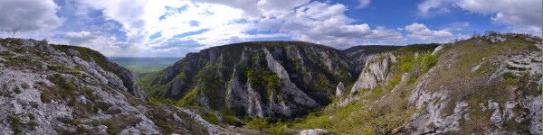
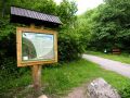
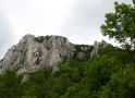
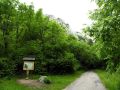
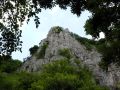
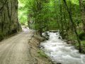
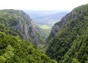
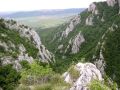
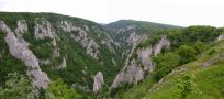
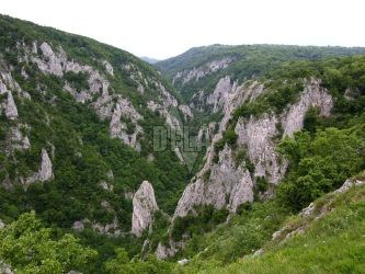
    Zádielská Ravine is a typical karst 3 km long valley, not far from the village of Zádiel. It is situated in the National park of the Slovak Karst (Slovenský kras) between the plains of Upper Hill (Horný vrch) and Zádielská Plain (Zádielská planina).
    It was created by intense erosive processes of the creek of Blatnica. It is up to 10 m wide and its steep limestone cliffs are about 300 m high. At the entrance of the ravine which is called Paradise Gate (Rajská brána) there is situated a rocky formation Cukrová homoľa. The lower part of the ravine is noticeably rockier than the upper part. Interesting archaeological findings were discovered in the caves which are situated in the Zádielská Ravine.
    Zádielská Ravine is a well preserved area which is rich on mountain and meadow flora and fauna. It provides an evidence of the development of the local vegetation and animals in the period following the Ice Age and the impact of the relief to the occurrence of species.

WEBCAMERAS:
    
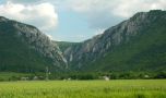
Pohľad na Zádielskú tiesňavu

PANORAMIC PHOTOS:
    Zádielská tiesňava - Pohľad do tiesňavy z bočných skalných útesov
   

MAPS:
         

PHOTO ALBUMS:


Spiš | Gemer | Liptov | Horehronie | Slovak Paradise | High Tatras | Low Tatras | Belianske Tatras
Pieniny | Spiš Castle | St. James’s Church | castle of Stará Ľubovňa | Krásna Hôrka | AquaCity | Bešeňová | Tatralandia | Vrbov | Vyšné Ružbachy